A Tax Authority is a government entity authorized by law to assess, levy and collect taxes. It provides services to property owners and has a distinct boundary. The local taxing authorities (county, school district, city, fire protection, and other special districts) set mill levies. The mill levy requested by each taxing authority is based on a projected budget and the property tax revenue required to adequately fund the services it provides to its taxpayers.
Due to requirements under HB21-1110, all pdf documents regarding abstract, certification, and mill levy reports can be obtained by emailing us at [email protected] or by calling our office at 720-523-6038.
Abstract Reports
The Abstracts by Authorities report shows the total assessed valuation for a taxing authority by the property classification in an abbreviated manner as of a specific date.
2024 Abstract Summary for All Authorities-Final
2024 Abstract of Assessment and Tax Levies
Mill Levy Report and Certification of Levies and Revenue
The levy reports present a list of the tax areas in Adams County. Each tax area represents a unique combination of taxing authorities in the County.
All real estate properties in one tax area are in the same overlapping tax authorities. While each tax authority sets its own mill levy, the sum of the individual authority levies within the tax area is used to calculate the property tax paid for property within the tax area. Each tax area consists of different combinations of tax authorities. Therefore, the mill levies for most, if not all areas, differ. The breakdowns in each tax area show the tax authorities and the levies within the area. The total levy for the authorities within an area equals the levy which is multiplied by assessed value to determine property taxes.
2024 Certification Of Valuation Letters-Final
2024 Mill Levy Report Tax Year - Payable 2025
2024 Tax Areas Authority Report
Authority Address Listing
The State of Colorado, Department of Local Affairs, Division of Local Government maintain listings of addresses for all taxing entities in the state of Colorado. Please click on the link below to go directly to the Division of Local Government’s webpage for Adams County (scroll down on the webpage that opens in order to see the alphabetical listing of authorities).
Tax Authority Application
Tax Authority application* consists of three tools:
- Ownership Listing: can be used to identify and download parcel information for properties within a specified Authority.
- Tax Authority Map: create a map of Adams County’s current boundary for a specified Authority.
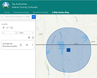
- 3-Mile Radius Map: can be used to identify and download the selection of all Taxing Authorities within a 3-mile radius of a specified Authority.
* This application is best when used on a computer.
To open it, click on the image below:


